
 no reviews
Sat nav purchasing advice: how to choose the right product
- What you need to know
- Satnavs use GPS to determine the exact position of a vehicle. Once the driver has entered their destination, the device finds a route and gives verbal instructions.
- Despite growing competition from smartphone apps, owning a satnav can still come in handy. Their biggest advantage is that they work independently from the mobile internet network.
- Navigation devices should have a clear display and be intuitive to operate.
- Further useful functions include voice activated control, speed monitoring, and a rear-view camera. Such cameras are particularly useful for caravans and mobile homes.
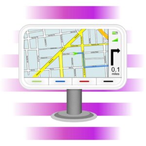
A map reader in your pocket
Thanks to navigation devices (or satnavs as they are more commonly known), cumbersome street maps have become a thing of the past. Satnavs take a start and end point and navigate a driver safely between the two using visual prompts and audible instructions like, “in 100 meters, turn left”.
What are the different types of navigation devices?
Navigation devices can generally be divided into three main categories:
Mobile navigation system
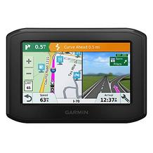
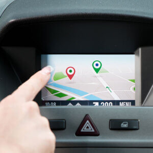
Mobile navigation systems include the satnavs most commonly found in shops. Most of them come with a mounting or clip which allows them to be attached to the windshield. This text will primarily focus on this type of navigation device. Satnavs are easy to install and uninstall and can be kept in the glove box or removed from the car at the end of a journey.
Built-in navigation system
This type of satnav is built into the vehicle itself and accesses information via the radio connection. Built-in satnavs are often the control centre for a vehicle’s multimedia system. This includes radio, CD drive and USB connection. They are generally much more expensive than mobile satnavs. Hence, the financial impact, if stolen, is more severe. Unlike with mobile satnavs, built-in models are not removable.
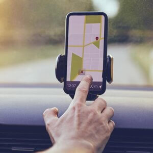
Smartphone navigation apps
There are a number of apps available for iOS and Android devices which perform the function of a navigation device. The upside of this is that no separate device needs to be bought, while most of the apps are themselves free to download. The downside, of course, is that these apps require lots of mobile data and battery.
Statistics from the rental company Europcar from 2018 showed that 28% of drivers in the UK would be completely lost without their satnav. Sales of satnavs are, however, slowly retreating due to the popularity of built-in satnavs and smartphone apps. What a lot of people may overlook are all the ways in which mobile navigation systems are superior to the competition.
Even though smartphones now all come with maps and route planners, satnavs cannot yet be considered outdated technology. It is true that navigation apps are usually free and easy to use, but there are still a number of areas in which satnavs are superior.
No mobile internet
Using your smartphone as a navigation system usually requires a stable mobile internet connection. This can become a massive problem if you are driving in areas with bad signal or an unstable internet connection. Route-planning apps, meanwhile, take up an enormous amount of data. Google Maps, for example, uses up to 3.1MB a minute whilst in use. If you are overseas, this can become expensive very quickly. It is often possible to buy data-volume packages although a stable and quick internet connection is required to download these in the first place. In addition, these packages take up a lot of memory. By contrast, satnavs do not rely on an internet connection. Instead, they have street maps preinstalled. This helps to save users money, as well as avoid the problems that arise from being in a foreign country in an area with poor signal.
Battery saving
Saving mobile data isn’t the only area in which satnavs are better than smartphone apps. Smartphone apps are well known for being extremely demanding on the phone’s battery life. It goes without saying that navigation devices use energy, but their consumption is a lot lower. A smartphone, meanwhile, needs to be used for a whole host of different tasks, like messaging and social media. In contrast, a satnav is a dedicated device which only needs to be used for route finding purposes.
Accessories included upon purchase
When buying a navigation device, the most important accessories are usually the charging cable, which attaches to the cigarette lighter, and the mounting, which allows the device to be attached to the windshield. Updates for the memory card are included in the price of the original purchase. Those looking to use their smartphone as satnavs must purchase all these accessories separately.
High customer satisfaction
Due to the fact that navigation devices are only conceived for one particular task, their software and interface are usually simple to use. The navigation function is usually the first option available once the device has been switched on. Users turn the satnav on, choose a destination, and are ready to go. With smartphones, on the other hand, the home screen has to be unlocked and the correct app found, before you can begin to navigate. Moreover, when using a satnav, you don’t run the risk of being distracted from driving due to a call or message. Some users also prefer the fact that the satnav screen is usually larger than that of a smartphone.
Shared usage
Another advantage of a satnav is that it can be used by anyone with access to a vehicle. With shared cars, for example, this can be a big advantage. Losing a satnav to theft is also less damaging than losing a smartphone. The loss of a satnav merely has financial ramifications. Unlike with a smartphone, you don’t have to worry about the loss of personal data.
The advantages of a satnav
- Doesn’t necessarily use mobile data
- Not battery intensive
- Necessary accessories and card updates included in price at purchase
- Simple to use
- High customer satisfaction
- Can be shared by any number of users
- No risk of losing private data in the event of theft
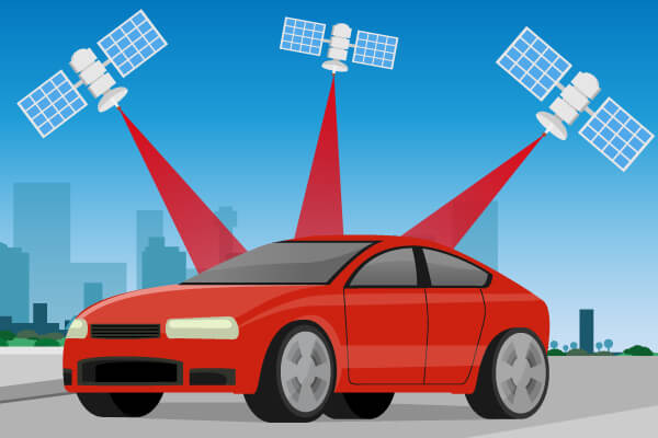
Lots of drivers put their trust in satnavs, in order to get from A to B. How a satnav actually makes this happen, remains a mystery to most. At their core, satnavs employ GPS (Global Positioning System) technology. This uses information from satellites which are in constant orbit around the planet. The original use of GPS was primarily for military purposes. In the last 20 years, this technology has become accessible to private individuals. GPS can be used to work out positions with an accuracy of up to around 10 meters.
The first satnav for cars
A distant forefather of the modern satnav was first developed in the 1930s and named Iter Avto. Translated, it means something like ‘the path of the car.’ It worked as follows: users transposed a defined route onto a paper roller, which was then inserted into the device. Inside the Iter Avto was a coil, which was connected to the vehicle drive. Depending on the speed of the vehicle, the paper was fed through the device either faster or slower.
Using satellites to find your position
The way in which a navigation device works can be best explained with a comparison to a mathematical equation. The position of the vehicle is our unknown in this equation. We therefore need certain parameters which can help us to work out this particular unknown value:
Satellites never leave their orbits. This means that we can always know their exact position. This Information is transmitted constantly. Navigation devices are capable of communicating with satellites in order to work out their position at any given moment. The basis for working out the position and speed of a vehicle is therefore the time needed for the information to be requested by the satnav until the moment it is received by the satellite. To receive a clear position, data is needed from at least three satellites.
Memory card information
Knowing the location of the vehicle is clearly not enough to bring a driver from start to finish of their journey. Certain information therefore must be stored on the device’s memory card. Popular models, for example those from the brand TomTom, come with preinstalled maps for the entirety of Europe. Maps for the rest of the world can either be downloaded or purchased separately. To ensure that you receive reliable information, it is important that the memory card is regularly updated. Manufacturers are responsible for making these updates available. They are usually included at purchase.
What to look out for
Finding the right kind of navigation device completely depends on your own personal criteria. We’ll analyse the most important factors influencing this decision in the following section.
Size and quality of the display
The size and quality of the display are two particularly important features of a satnav. A display should be large enough that users can easily read all the important information regarding their journey, their current position, the route ahead, and the expected time of arrival. Satnavs with larger displays are easier to use as their buttons and icons are correspondingly large. Most satnavs available in shops have a 4-inch display (around 10cm) which is easily sufficient. Those looking to display their satnav on the dashboard should make sure to not buy too large a satnav, as it might obscure the view. Matt or anti-reflective displays can still be read in sunny conditions.
Highway code, road safety, and vehicle rules
The UK government stipulates that it is illegal to hold a phone or satnav while driving. Hands-free devices, such as a Bluetooth headset, a dashboard holder, or built-in satnav, are, however, permitted, provided that they don’t block your view of the road ahead. This law applies equally if you are stopped at traffic lights or queuing in traffic.
Capacitive or resistive touchscreen — which one is better?
Modern satnavs are nearly always equipped with a touchscreen. Models differ from one another in that they employ either a capacitive or resistive touchscreen. Capacitive touchscreens can only be controlled with conductive objects, like a finger. They do not require any pressure to be exerted. Resistive touchscreens, meanwhile, can be controlled by fingernails, a pencil, or a hand wearing a glove. In order for the screen to react, pressure must be exerted. The choice between these two systems is up to the personal preferences of the user. Those who often wear gloves while driving may be better suited to using a resistive display. On the other hand, zooming in and flicking through menus is much easier with a capacitive display.
Intuitive menus
The ease of use generally depends on the quality of the display and the software the device employs. A good satnav should be so intuitive that users don’t have to study a manual before their first use. In the best-case scenario, all the important functions would be easy to find and understand, allowing the user to quickly work out their route without having to waste time clicking through endless menus.
Voice activation
Satnavs which employ voice activation are some of the easiest to use. They can be used without the driver having to lift their hands from the wheel. The voice activation in modern models has come on leaps and bounds from those of the past. Loud background noise, like an open window or radio, can negatively affect the efficacy of voice activation. Some models, like the TomTom Go 6200, can connect to smartphones, allowing users to use voice-activated assistants like Google Assistant or Siri.
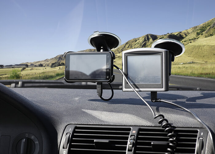
The mounting
Lots of navigation devices come with a suction cup mounting which can attach to the windscreen. Should you choose to attach your satnav to the windscreen, you should ensure that it doesn’t obscure your view while driving. This is more likely to be a problem with larger models. Others can be mounted and fastened onto the dashboard. Cheaper models often don’t come with a mounting, meaning that one may have to be purchased separately.
Power supply
If a satnav is in use throughout the length of an entire journey, then a power supply may be needed to ensure that the GPS remains connected. Most models come with a 12V charging cable which connects to the cigarette lighter. Some modern models come instead with a USB charger or a battery, allowing them to be used, for a certain period of time at least, without a cable. This is particularly useful for those intending to use their satnavs on a bicycle or motorbike which does not have access to a power source. Anyone who needs to use their satnav for more than four hours at a time should be aware of this when making their purchase decision.
Maps and updates
It pays to know where you intend to use your satnav before making the decision to buy one. Most models come with map information for the UK and a few other European countries preinstalled. Extra maps can usually be bought but may cost more depending on the manufacturer. Lots of satnavs come with map packages for the whole of Europe. Generally, it is cheaper to buy a satnav with preinstalled maps than to buy them separately later.
Keeping your maps up to date
Users should pay attention to the number of maps available on their satnav at the point of purchase, as well as the availability and regularity of updates. Even the best satnav is useless without up-to-date information. Updates used to always be fee-based and unreasonably expensive. The competition provided by smartphone apps has, however, become so strong, that most manufacturers now offer these updates for free. Manufacturers often guarantee these updates over the lifespan of the product. To apply for these updates, users must first register their device with the manufacturer. Updates are downloaded to a computer and then transferred to the device using a USB connection. Some of the better models update their maps automatically.
Memory
Map updates contain a lot of information and take up a lot of memory. It’s therefore important that a satnav has enough memory capacity. Most memory cards have 8GB or 16GB of memory. If the memory is 8GB or less, additional memory can usually be added through the SD card slot.
Connectivity
Keeping your satnav connected with the internet and other devices has become essential for most users. Lots of models are equipped with both Wi-Fi and Bluetooth. This allows the user to update their satnav without having to connect it to another device. An internet connection is required to receive up-to-date information on traffic and weather. Bluetooth allows a satnav to connect to a smartphone without the need for internet. Once connected, the satnav can be used as a hands-free accessory of the smartphone.
More expensive navigation devices tend to come with several added features on top of the basic package. Users should make sure that the number of features doesn’t inhibit the ease of use of the product. In an attempt to keep up with the smartphone app market, manufacturers have begun to overload their satnavs with added features. This can be particularly confusing for first-time users, if they are confronted with convoluted menus and a list of functions that they will never need. Sometimes less really is more.
Which added features are useful for a navigation system depends on the user’s personal preferences and how they wish to use the satnav. The most common of these features can be found in the following section:

Points of interest (POI)
Some satnavs offer the possibility to show various points of interest — places close to the route which could be of interest to the driver. These could include petrol stations, parking, garages, and attractions. Lots of these locations are stored on the satnav’s memory card, together with the map information. They are usually shown during the journey superimposed on the map. Depending on the settings, they can even be verbalised by the voice activation software. In most cases, the databank of locations can be expanded with the help of point of interest collections, which can usually be downloaded for free online. Here, you should make sure that the file format is compatible with your model of satnav. Some manufacturers like GARMIN have a list on their website where you can find information about points of interest.
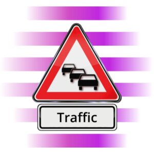
Receiving traffic information
Satnavs that are able to receive traffic information can take factors like weather, accidents, and roadworks into account when planning the best route. Should a traffic jam arise, they can suggest a completely new route to the driver. One way to receive traffic information is through the free system TMC (Traffic Message Channel). Unfortunately, the channel is only updated every 15 minutes. This means that there is no guarantee that the updates are completely up to date. TMCpro is a more accurate system which uses sensors installed in the roads to measure current traffic. Using this system requires payment, although this is often included in the price at purchase of a satnav. The most reliable way to stay up to date is through live services. Live services report current traffic information and details. To use a live service, an internet connection is required. Luckily, most modern models offer this possibility.
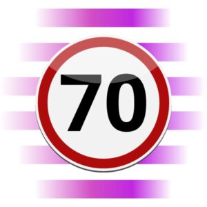
Speed monitoring
Depending on the type of navigation system used, satnavs can offer speed monitoring assistance. Most satnavs have the speed limits saved onto their hard drive. Using GPS signal, a satnav can work out the speed limit at any given moment and give the driver a visual or audible warning if this limit is exceeded.
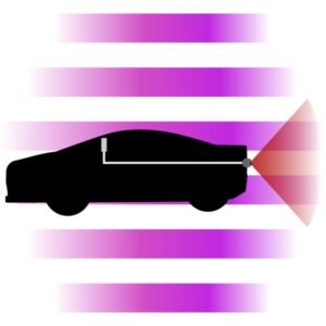
Reversing camera
A reversing camera is another added feature which is particularly useful for mobile homeowners. Some mobile satnavs include this function or something similar, although it is more commonly found in built-in models. The reverse camera is used primarily as a parking aid and is activated as soon as the driver puts the car into reverse. The satnav displays the camera view and shows the driver how best to park with graphics aids.
Choosing the route
Lots of navigation systems can suggest a number of potential routes for the driver to choose from. Most drivers make the choice between the shortest and the quickest routes. The shortest route is calculated using kilometres and does not take into account potential obstacles along the way. Some models even offer the ability to show the prettiest available route. Sometimes, users can enter information about desired rest stops they wish to make, as well as a preference for or against driving on the highway.
This comparison has so far focused on satnavs designed for use in a car. The use of these devices can be transferrable to other types of vehicles, such as trucks or mobile homes. There are, however, specific models which offer specialist features for more specific usages.
Camping holidays with a specialised satnav
Camping fans with their own caravans or mobile homes can reap the benefit of having a specialised camping satnav. Navigation systems specially designed for caravans and mobile homes can take into account the size of the vehicle when planning a route, helping to avoid any height or weight restrictions along the way. The type of vehicle is also included in the calculation of the arrival time. Lots of camping satnavs have a rear-view camera which aids drivers while parking with large and cumbersome vehicles where the lines of sight can be obscured. Another advantage of camping satnavs is that they come with detailed information about mobile home parks and camping spaces preinstalled. Lots of models allow the user to switch between camping and normal car modes, removing the need for the user to buy an extra satnav for both vehicles.
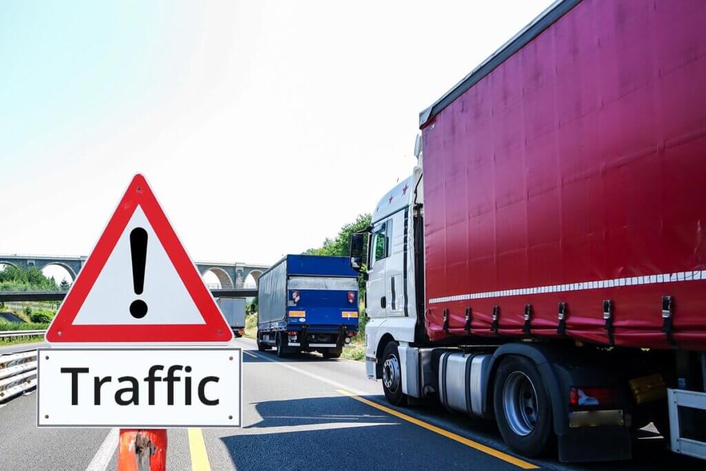
Simplified and faster haulage with truck-satnavs
It is particularly important for truck drivers that they arrive quickly and safely to their destination. At the end of the day, their pay relies upon deliveries being made within certain timeframes.
Obstacles like a low bridge can be fatal to a truck driver’s delivery attempt. Satnavs for trucks take into account the dimensions of a truck when calculating their route. Most of these systems also come with up-to-date maps and automatic updates. Live services often come preinstalled, giving the driver up-to-date information about potential hold-ups or traffic problems on the road ahead. To counteract the larger distance between dashboard and driver, most satnavs for truckers are slightly larger in size, often having a screen of between five to seven inches.
Getting motorcyclists safely and directly to their destination
Another area in which specialised satnavs are recommended is for motorcyclists. Unlike with other types of vehicles, the satnav is usually exposed to the elements while in use by a motorcyclist. This means that it should be waterproof enough to withstand even the heaviest of rainfalls. It is also important that the screen remains visible, even when exposed to direct sunlight. For this reason, most motorcycle satnavs have glare protection or an anti–reflective display. Seeing as the device often needs to be operated while the rider is wearing gloves, most satnavs for motorcycles come with a resistive touchscreen. If this is not the case, then riders are required to use screen gloves.
Motorcyclists usually have no way to connect their satnav to a power supply. For this reason, good motorcycle satnavs require a long battery life. Riders who rely on voice control instructions rather than the visual display require a headset that can connect with the device via Bluetooth. This is often included upon purchase.
Once you’ve found your perfect satnav, the only question that remains is the best way to secure it to your vehicle.
Keeping the view clear
When looking for the best way to install your satnav, the primary concern should be to not obscure your field of view while driving. The worst place to position a satnav is underneath the rear-view mirror, as this creates a blind spot which can significantly raise the possibility of an accident occurring. Larger satnavs can also obscure the view if they are positioned centrally on the windshield.
Punishment for incorrect installation
Laws surrounding the installation of satnavs are at best fuzzy. That said, the punishment for using a phone or satnav while driving is not. It could result in a £200 fine and six points on your license. Clear advice from manufacturers states that a satnav should not interfere with the vehicle operating controls or obstruct a drivers view, nor should it distract a driver, should it fall down from the windshield.
Drivers should also be aware to not position their satnav in a location that could interfere with the airbags in the event of an accident.
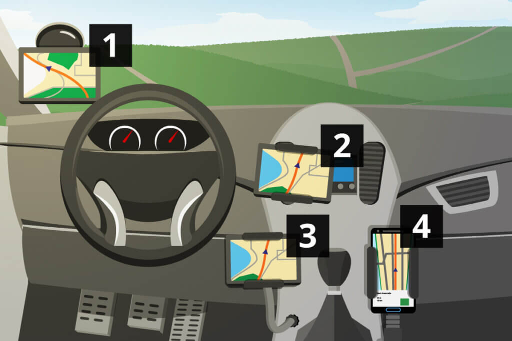
Best position for a satnav
The best positions for a satnav are as follows:
In the bottom left–hand corner of the windshield: the satnav remains out of the drivers view of the road. Similarly, heavier models can rest on the dashboard.
On the air vents to the right of the driver: with the correct kind of mounting, you can securely fasten your satnav to the air vents. This also allows the passenger to use the device while underway.
In the central console on the drink holder: for this model, another specific kind of mounting is required. These mountings usually offer a high level of stability.
Direct attachment to the cigarette lighter: special attachments can be used to fasten a satnav directly into the cigarette lighter with a built-in charging cable.
The correct kind of mounting
Depending on where in the vehicle the driver wishes to place their satnav, a specific kind of mounting may be required. A suction cup on the window is commonly used for this. There is, however, always the risk that the suction cup falls off while driving. To help avoid this, users should make sure that their windscreen is clean and dry before they attach the suction cup. It is also recommended that users replace their suction cup after a certain period of use, as they are liable to deterioration and loss of stickiness.
The most stable kinds of mounting are the ones held on the drink holder or the air vent. It is important that they are correctly attached as to not cause damage to the vehicle.
To connect a satnav to the cigarette lighter, users need a mounting with a corresponding connector. The advantage of this is that the charging cable is built into the mounting. Unfortunately, these mountings can become wobbly over time under the strains of wear and tear.
How do I attach a satnav to a motorcycle?
Manufacturers have come up with a number of ways to attach satnavs to a motorcycle. The easiest way to do this is to mount it to the handlebars. Usually, a clamp is used to do this. Other plausible positions are in the centre of the handlebars or next to the mirrors. Those who don’t wish to have a special mounting attached to their motorbike can buy bags or pockets which come with a transparent outer surface. This allows for a satnav to be slotted inside and stored while driving. Any such bag can then be strapped to the tank of the motorbike.
Image 1: © FinalCheck | Image 2: © bilanol / stock.adobe.com | Image 3: © StockPhotoPro / stock.adobe.com | Image 4: © Rostislav Sedlacek / stock.adobe.com | Image 5: © Bäckersjunge / stock.adobe.com | Images 6-11: © FinalCheck | Image 12: © kerkezz / stock.adobe.com | Image 13: © FinalCheck